


THE OLD ELEPHANT ROUTE EXPEDITION
by Prajna Chowta
A project supported by AsECF (USA), AERCC (India)
The Old Elephant Route project was designed and conducted to study the past and present migration of wild elephants on the border area between Burma and north-eastern India as well as the viability of this corridor as a migratory route in a region which is located at the geographic heart of the elephant habitat in Asia.
For millions of years, and until the beginning of human civilisation, elephants were able to move freely in an uninterrupted territory that covered the whole of South Asia, from the mouth of the Indus river (today in Pakistan), to the whole of India and South East Asia and the south of China. Up to the 18th century or so, they could still enjoy a continuous territory that stretched between what is today known as Vietnam, Cambodia, Laos, Thailand, Burma, North-East India and Bengal (Bangladesh + West Bengal), up to the foothills of the Himalayas, and corridors probably still existed between the actual Indian states of West Bengal, Bihar, Chattisghar, Orissa, Andra Pradesh, Karnataka, Tamil Nadu and Kerala in the south of the Indian subcontinent.
In the last two hundred years, these natural migratory routes have been further interrupted in many places by an ever-increasing occupation of land by human beings and an unrelenting abuse of the natural resources found in forests. Consequently, the elephant population has decreased dramatically (down to about 40,000 today) and has been divided physically and genetically into many small, isolated groups, surviving in pocket areas disseminated all along in what may be called The Old Elephant Route.
The Patkai Range, which forms a natural boundary between India and Burma (renamed Myanmar by the military junta in 1989), is therefore a strategic platform in the elephant habitat since it allows an interaction between the elephant populations of south-east Asia and of India, thus preserving a natural genetic link between two of the largest populations of elephants.
Due to its location between China, South-East Asia and the Indian subcontinent, this region is also politically sensitive, especially since World War II. The border is closely guarded on either side by the armies of the respective countries and its access is restricted. This explains why few elephant surveys have been conducted in the region and why so little information is available on the subject.
In recent literature about elephants in Burma or North-East India, the only mention of elephant migration between the two countries can be found in a brief note by P. D. Stracey in his book Elephant Gold. P. D. Stracey reports that Errol Grey, a rich tea planter who was involved in the capture and sale of elephants, when travelling through the "Chowkham Pass" (in 1894), at an altitude of about 9000 feet with a convoy of captive elephants to be sold in Burma, "found elephant tracks worn deep in the soft sandstone rock which must have been made by generations of wild elephants migrating to and fro across the Patkai Ranges." (Elephant Gold, 1963, p. 27)
The spelling of the Chowkham Pass by P. D. Stracey is in fact mistaken with that of Chowkham (or Chongkham) in Lohit District of Arunachal Pradesh. The pass travelled by Errol Grey appears on most maps of the region as 'Chaukan'. This mountain pass, at an altitude of about 5000 ft (the Chaukan Bum or hill is 8000ft high), is situated exactly on the border between India and Burma, respectively in the neighbouring states of Arunachal Pradesh and Kachin.
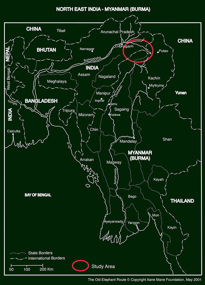
Our initial approach of this region was to travel from Rangoon (or Yangon) the capital of Burma, up north, following old or actual elephant migratory routes, and cross the border to India through the Chaukan Pass.
A first meeting with the Ambassador of Myanmar in New Delhi took place in December 1998. It led to an official invitation to Rangoon.
We first travelled to Rangoon in March 1999, where officers of the Foreign Division of the Ministry of Defence welcomed us. Meetings took place with the Myanmar Timber Enterprises to discuss the project. We were offered a visit to an elephant camp in Pegu Yoma and were finally asked to send a detailed proposal upon our return to India.
A positive reply came from the Ministry of Forestry through the Embassy of Myanmar in New Delhi in July 1999.
We travelled again to Rangoon from Calcutta on the 1st of January 2000.
Meetings took place on January 3, 5, 7 and 10 at the Ministry of Forestry with the DG of the Survey Department and his staff.
Discussions held in March '99 during the preparatory trip and numerous letters exchanged where synthesized.
It appeared that no one had any first-hand information about the forest areas beyond the town of Khamti, on the upper Chindwin River.
In fact, MTE (Myanmar Timber Enterprise, the commercial agency of the Ministry of Forestry) does not operate further north than Hommalinn, while the territory under management of the Forest Department ends at the level of Khamti.
However, on the 10th of January, all practical details were finalized. We were then asked to wait for a few days for a security clearance in Kachin State.
On the 24th of January, we were called to the DG, Survey Department office, and were informed that the Minister of Forestry had stopped the project. No explanation was given. No compromise or alternative plan was offered.
We then decided to approach the Chaukan Pass from the Indian side, for which special permits need to be obtained in New Delhi and Itanagar, the capital of Arunachal Pradesh, in order to enter the protected area of the state bordering Myanmar.
A first expedition took place between February and early April 2000 with a team including:
— Ms. Prajna Chowta, project officer, Aane Mane Foundation, India.
— Mr. Surendra Varma, field biologist, Indian Institute of Science, India
— Mr. Mujeeb Khan, mahout, Karnataka Forest Department, India.
— Mr. Philippe Gautier, coordinator, Aane Mane Foundation, India.
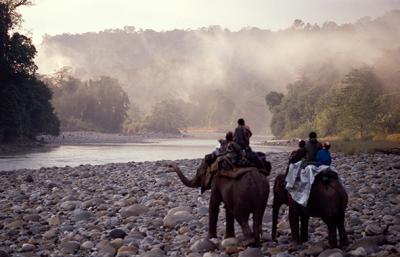
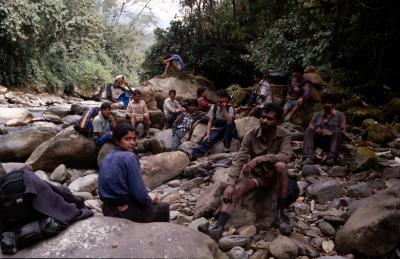
The access to the Chaukan Pass by land requires a trek of about 165 km from Deban, the Forest Department base camp in Namdapha National Park since no motorable road exists in the area. Our first attempt was done with the help of 3 pack-elephants and 6 porters but we were forced to turn back after about 85 km because of a dangerous landslide and heavy rainfall. We then tried, unsuccessfully, to get permission to be airlifted by the army helicopters to Vijoynagar. A few days were spent travelling to Pangsau Pass, where the Stillwell Road, built during WWII, enters Burma, and we were allowed to cross the international border on the occasion of the bi-monthly market that takes place in the village of Pangsau.
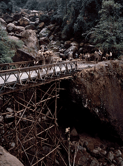
On the 19th of March, we started to walk again with 9 porters towards Vijoynagar, which we reached after 6 and a half-day trek. Another two-day march took us to the Chaukan Pass, after which we returned to Vijoynagar.
We then waited one week for the weather to clear up and were finally airlifted by an Indian Air Force helicopter to Dibrugarh, Assam.
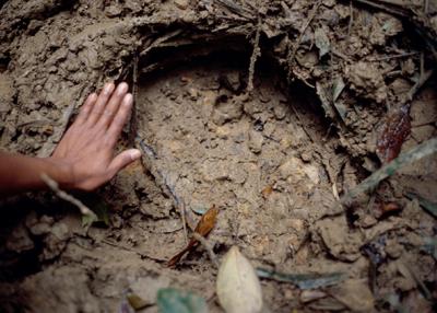
A second expedition took place between December 2000 and February 2001 with the objectives to continue the survey of the international border, from the western boundary of Namdapha National Park to the border of Nagaland Sate, and to collect general information about the situation of elephants in Lohit District of Arunachal Pradesh, that shares borders with China and Burma. It was difficult to put together a team of volunteers to spend three months in North-East India which was then in a high crisis of political violence. The killing of 28 innocents villagers in Tinsukia District, early December and the subsequent military operations against insurgents in inhabited areas as well as in jungles, the imposition of a curfew, the regular patrolling and check-posts on all roads give a rough idea of the atmosphere in Assam and Arunachal at the time when we started our second expedition.
However, all our objectives were met, and we discovered one living migratory route of wild elephants across the border with Myanmar. We also collected enough information to draw a map of the movements of elephants in the region. Moreover, the second expedition allowed us to realize the exceptional complexity of the political and sociological situation in the region, and to understand its impact on the elephants and their habitat.
In fact, the region is mainly inhabited by a series of tribal populations, with different traditions and languages, various degrees of development, broken down into a network of international and administrative boundaries, under various political status, but sharing the same essential, life-sustaining resources of the forest.
Therefore, and probably more than in the case of any other region in India, it is essential to take the socio-political situation into account in order to evaluate the present state of wild-life and its habitat.
Secondly, it appears that in spite of heavy timber extraction, which has now been banned, substantial portions of the border area are still covered with forests, and that the main threat to the elephant is poaching.
Finally, we have tried to establish whether the isolation of the elephant populations of India and Burma has had an impact on the species. In this end, elephant's hair samples were collected both in Burma and India along the expedition, and a comparative DNA analysis was conducted by Régis Debruyne, under the supervision of Prof. Pascal Tassy of the National Museum of Natural History, Paris, France. Their experience in studying the DNA of elephant populations in Asia and Africa in comparison with the mammoths made them the appropriate collaborators in this regard.
>> To get a full report, write to contact@aanemane.org
© Copyright 2008-2025 Aane Mane Foundation.
All rights reserved. Web design by Lor.